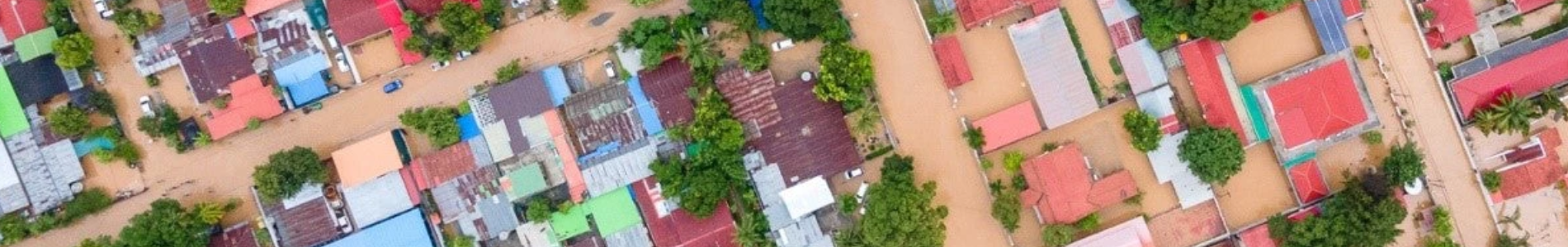
The Urgency: Why Tropical and Urban Cities Are at the Center of Climate Risk
As the planet warms and weather extremes intensify, urban areas are becoming the epicenters of climate impact. Heatwaves, flash floods, and extreme precipitation increasingly threaten cities—particularly in tropical and subtropical regions, where high population density and vulnerable infrastructure compound the risks. Yet, current global models, optimized for mid-latitude systems, are not equipped to capture the unique dynamics of tropical cities.
What is urgently needed is not just more computing power, but better science. The HKUST initiative pioneers a new approach: rebuilding model physics to address tropical convection, land-sea interactions, and urban-atmosphere feedbacks. Unlike traditional methods, our work ensures sharper, more accurate predictions tailored to the challenges of tropical urban environments—empowering cities to adapt and thrive amidst accelerating climate risks.
What Makes Our Modeling System Unique
Most weather and climate models in use today were originally developed for large-scale, mid-latitude dynamics. When applied to tropical cities, especially in high-density urban environments, these models often fall short—not just due to resolution limits, but because they fail to represent key physical processes. This is where our modeling system fundamentally diverges from the rest.
At HKUST, we are model developers, not merely users. Our work is focused on rebuilding the physics of the model itself, tailoring it to the fast-evolving convective systems and the urban complexity of tropical regions. This includes:
- Explicit representation of land–sea breezes, critical in coastal cities like Hong Kong and Jakarta.
- Improved treatment of moist convection, capturing the short-lived but intense storms common in the tropics.
- Realistic simulation of urban physical processes, such as building heat storage, radiative trapping, canyon effects, and artificial heat emissions.
These improvements go far beyond applying surface land-use data or adding urban canopy schemes to existing models. They represent a bottom-up enhancement of the modeling framework, ensuring that forecasts are grounded in physics that truly reflect tropical urban environments.
AI as an Accelerator
A critical enabler of our system is Artificial Intelligence (AI)—but with a fundamentally different role than in many conventional approaches. Instead of using AI to simply “fix” coarse model outputs, we apply it after improving the underlying model physics. AI is used to
- accelerate computation,
- optimize input assimilation,
- and enhance output resolution and usability.
For example, we use machine learning to speed up the generation of street-level exposure maps, to support real-time decision-making during extreme events. In this way, AI complements, rather than replaces, the core physical understanding that drives predictive accuracy.
Modeling Hazards, Impacts, and Adaptation: All Interactively
What further distinguishes our approach is our ability to model not just hazards, but impacts—and more importantly, how those impacts evolve with adaptation. In our system, urban adaptation measures are not external scenarios; they are interactive components of the model.
We simulate:
- Green roofs and walls, including evapotranspiration and thermal buffering
- White roofs and high-albedo surfaces, affecting urban energy balance
- Urban forestry and biodiversity corridors, contributing to cooling and pollutant removal
- Distributed solar panels, influencing energy and heat flux dynamics
This two-way coupling allows us to answer critical questions like:
How much cooling will rooftop greening provide under future heatwaves?
How does a city’s risk profile change with widespread white roofing?
It also enables dynamic risk forecasting, where exposure is recalculated continuously based on climatic inputs and ongoing adaptation strategies.
A Platform for Decision-Making, Not Just Forecasting
In short, our modeling system is not only a tool for forecasting; it is a platform for decision-making. It helps governments, planners, insurers, and communities design smarter responses—by providing actionable insights grounded in scientific rigor, urban realism, and computational efficiency.
Our Vision: Building the Next-Generation Tropical Urban Weather and Climate Prediction System
We envision a future where cities across the tropics are equipped with the scientific tools and predictive systems they need to prepare for, adapt to, and thrive amidst accelerating climate risks. Our goal is to build the next-generation Tropical Urban Weather and Climate Prediction System—a modeling and decision-support platform that is physically accurate, operationally usable, and globally connected.
Urban areas, especially in tropical and subtropical regions, are already bearing the brunt of climate change. Yet they remain underserved by traditional global models, which were primarily designed for mid-latitude regions and cannot adequately resolve the fast-evolving convection or complex urban interactions that shape weather extremes in these zones. Our system addresses this gap directly—through advanced model physics, real-time operational forecasting, and integration with adaptation strategies that cities can act on.